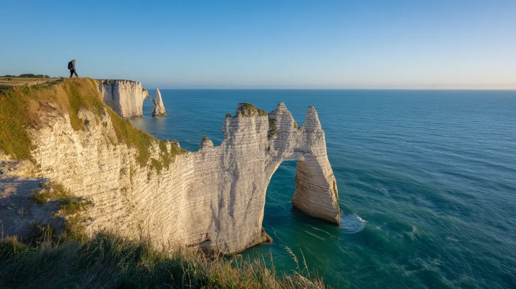
The Étretat cliffs are Normandy’s most photographed coastline for a reason: a chalk arch plunging into green water, a white needle of rock offshore, a sheer wall of cliff to the left. That exact photo is taken from a specific spot on the Falaise d’Aval, about 25 minutes on foot from the town center.
That’s the good news.
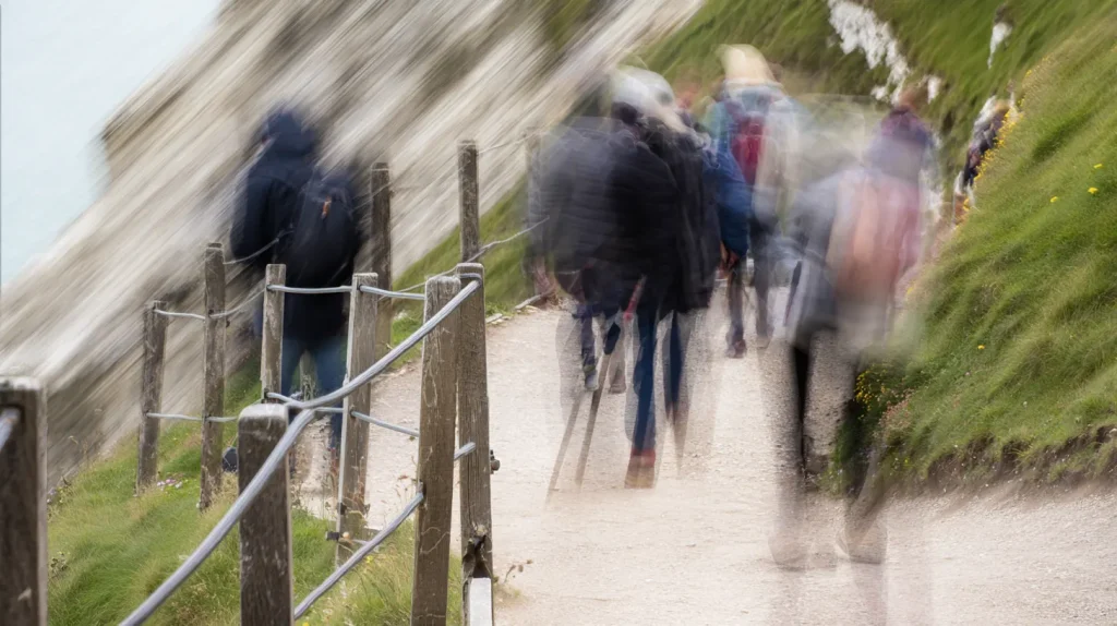
The crowd situation on a July or August weekend is what the photos don’t show. The path to the arch viewpoint is narrow, the viewpoint itself is a small fenced ledge, and the line of people waiting to stand there can stretch back along the cliff path for a hundred meters. You’ll get the shot. It’ll just take longer than you’d expect.
The other thing the photos don’t show: Manneporte, the third and largest arch at Étretat, sits a further stretch west along the coast beyond the Aval arch. Most visitors never get there. It’s substantially bigger than the Aval arch, reachable by cliff path above or, at low tide, along the beach below — and it’s almost always quiet.
Here’s how to see all of it properly.
The three formations (and what each one is)
Étretat has three distinct natural arches carved into its chalk cliffs.
Falaise d’Aval sits west of the beach. This is the one in every photograph — a curved arch with a narrow needle of rock (the Aiguille) standing offshore. The arch itself is impressive but often smaller in person than photos suggest. The cliff path above it gives you the famous downward view. This is where most visitors go, and where most visitors stop.
Falaise d’Amont sits east of the beach. Smaller and less dramatic from the water, but the top of the Amont cliff carries the Notre-Dame de la Garde chapel, a small white chapel that appears in several of Claude Monet’s Étretat paintings. The Jardins d’Étretat, a striking contemporary garden with cliff views, sits right next to it. The Amont is quieter than Aval simply because it’s the second stop, and plenty of visitors don’t make it this far.
Manneporte is the one worth the extra effort. It sits further west around the headland beyond the Aval arch — visible from the Aval viewpoint as a dark opening in the cliff face in the distance. Getting there means either taking the cliff path past the Aval arch and continuing west, or walking the beach at low tide beneath the cliffs. It’s a genuinely large natural arch, big enough to sail a small boat through, and usually has only a handful of people at it even when the main arches are packed.
The Aval circuit (west side)
From the town center, cross the beach and take the staircase on the left (west) side. It’s steep for the first few minutes, then the path follows the cliff edge toward the viewpoint above the arch.
The iconic view opens up after about 20 minutes of walking. On a clear morning — particularly in spring and autumn — the light on the chalk and the green of the sea can be genuinely spectacular. Monet came here repeatedly for a reason: estimates of exactly how many Étretat paintings he made vary by source, but most put the figure somewhere around fifty, made across multiple stays and different seasons, as he worked to capture how the light shifted across the cliffs. Standing there watching the color of the water change, the compulsion starts to make sense.
The arch itself, seen from directly above, looks smaller than the photographs suggest — partly because those photos are usually shot with a wide lens that compresses the scale, and partly because the viewpoint fence keeps you back from the edge. Walk further along the cliff path west, past the main viewpoint, and the formations open up more. From roughly 200 meters past the main viewpoint, you get a angle that shows the Aval arch in profile, with the Aiguille needle standing separate from the cliff face. It’s arguably a better photograph than the famous straight-down shot, and far fewer people are there to get it.
Past the main viewpoint, the path continues west above the Aval arch. If you want to reach Manneporte, keep going — the path descends briefly, then rises again along the cliff top, with views of the coastline stretching toward Le Havre. The full walk to Manneporte from town and back takes roughly 2.5 to 3 hours at an easy pace.
At low tide, you can walk the beach directly under the Aval arch and continue west to the base of Manneporte. The arch frames a view of sea and sky that’s entirely different from the view above. Standing beneath the Aval arch and looking up at the chalk — streaked grey, cream, and faintly orange from minerals in the rock — is something the top-down photograph doesn’t prepare you for. Check the tide schedule before attempting this: the beach route can be cut off as the tide rises, and the local tourist office publishes current tide times, so it’s worth confirming before you set out rather than guessing.
The Amont circuit (east side)
Take the staircase on the right (east) side of the beach to climb to the Amont cliff — the ascent is sharper than the Aval side. The chapel of Notre-Dame de la Garde at the top is small and often unlocked, worth a brief look inside.
The view from Amont looks back across the bay at the Aval arch, which from here reads more like a protruding headland than an open arch — a worthwhile perspective shift if you’ve already been to the Aval side.
Adjacent to the chapel, the Jardins d’Étretat is a contemporary garden of topiary and sculpted hedges shaped like waves, spirals, and other organic forms echoing the cliffs nearby. It was created in the 2010s on the site of a villa that once belonged to the French actress Madame Thébault, a friend of Monet’s, with landscape architect Alexandre Grivko behind the design. It’s not a conventional flower garden — it reads more like a design statement placed next to one of the most dramatic views in Normandy, and the effect is genuinely stranger and more interesting than most tourism copy prepares you for.
The garden sits right on the cliff edge, and the views from inside — across the bay and down to the beach — are some of the best in Étretat, offering a very different angle on the Aval arch than the main viewpoint gives you. Adult admission generally runs somewhere around €14 in peak season, with reduced rates for students, teens, and visitors with disabilities, and it’s worth checking current pricing directly since garden admission fees are adjusted periodically. Opening hours vary by season — generally from around 10am, with earlier closing times in the shoulder seasons and later closes in high summer. It’s worth booking online in advance if you’re visiting in July or August, since the garden has limited capacity and does sell out on summer weekends.
How long you actually need
Minimum (90 minutes to 2 hours): the Aval cliff walk to the arch viewpoint and back. You’ll get the main photograph, see the arch from above, and return the way you came — fine if you’re passing through with limited time.
Half day (3 to 4 hours): the Aval arch viewpoint, continuing on to Manneporte and back, then crossing the beach and climbing Amont for the chapel and/or the Jardins d’Étretat. This is the right amount of time for a proper visit.
Full day (5 to 6 hours): the above plus a longer circuit that crosses both cliff systems and loops through the countryside above the town, running to roughly 15 kilometers with meaningful elevation gain along the way. Good for walkers who want to go beyond the tourist circuit and see the landscape from further out.
The cliffs themselves are free to access, and no booking is needed for the cliff walks — just show up and go. The only entry fee anywhere on this circuit is for the Jardins d’Étretat. The surface on the Aval path is well-maintained gravel near the viewpoint, turning to grass and chalk further along toward Manneporte.
The crowd reality
Étretat is one of the most photographed spots in Normandy, and it shows in summer. On a Saturday or Sunday in July or August, the Aval viewpoint has a genuine queue, the narrow cliff path gets congested, and the beach below fills with day-trippers by mid-morning.
Coming in spring (April–May) or autumn (September–October) makes a real difference. The weather is less reliably warm, but the cliff paths stay open, the light is often better than the flat midday glare of summer, and the odds of having Manneporte to yourself are high.
On any summer weekend, arriving before 9am or after 6pm gets you ahead of the main crowd surge — the town is small enough that both parking and the paths feel manageable early in the morning. Weekdays throughout summer are meaningfully quieter than weekends.
Getting there and parking
Étretat sits roughly 25 to 27 kilometers (about a 30-minute drive) from Le Havre, and roughly an hour by car from Rouen. From Honfleur, the drive generally takes around 40 minutes to an hour, depending on the route.
Parking in town is limited and fills fast on summer weekends. The paid lots near the beach are the obvious option, but they’re often full by mid-morning. Several visitors recommend parking on the road coming into town and walking the final 10 to 15 minutes in. Arriving before 9am generally sidesteps the problem entirely.
There’s also a bus connection from Le Havre — operated by LIA, generally running close to hourly, with a journey time in the 40-to-60-minute range and a fare of just a few euros. Useful if you’re based in Le Havre without a car; for most Normandy visitors who are already driving, the car remains the more practical option.
There are no facilities on the cliff paths themselves — no toilets, no cafés — so bring water, especially for the Manneporte walk in summer. The beach area has a handful of seasonal cafés near the town center that get busy by midday. Eating in the village before heading up the cliffs, or bringing your own supplies, saves time later.
Étretat also has a covered market hall with local Norman produce on certain mornings each week — worth timing your arrival around if you’re already planning a morning visit, though it’s worth checking current market days locally since schedules can shift.
Frequently asked questions
Are the Étretat cliffs free to visit? Yes. The cliff walks and viewpoints are free, and so is the beach. The only paid attraction on the circuit is the Jardins d’Étretat on the Amont cliff, with adult admission generally running somewhere around €14 in peak season.
What is Manneporte and how do you get there? Manneporte is the third and largest natural arch at Étretat, located further west around the headland beyond the Falaise d’Aval. Most visitors miss it because reaching it requires either a longer cliff-path walk past the main viewpoint or a low-tide beach walk. It’s noticeably larger than the Aval arch and usually far quieter.
How long does it take to walk both cliffs at Étretat? The Aval circuit, including the extension to Manneporte, takes roughly 2.5 to 3 hours from town and back. The Amont circuit, with the chapel and garden, takes about 1 to 1.5 hours. Doing both, with some beach time in between, fills a full half-day — plan on roughly 3 to 4 hours total.
When is the best time to visit Étretat? April–May and September–October generally offer the best combination of weather, light, and manageable crowds. Mornings are consistently quieter than afternoons, and weekdays are quieter than weekends. In summer, arriving before 9am or after 6pm helps you avoid the worst of the viewpoint queues.
Can you walk on the beach under the cliffs? Yes, at low tide. You can walk beneath the Aval arch and continue west toward Manneporte along the beach — one of the best perspectives on the formations. Check tide times before setting out, since the beach route can be cut off as the tide rises and returning by cliff path from Manneporte takes real time; the local tourist office publishes current tide schedules.